|
Geologic History
Information, pictures and graphics provided by; Jay van Tassell, Professor of Geology Science department, Eastern Oregon University
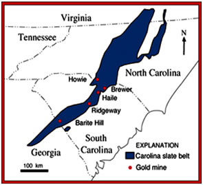
Kilburnie, the Inn at Craig Farm, is located in the region that geologists call the Carolina Volcanic Slate Belt (Fig.1). We call this the slate belt because the muddy sediments in this area were metamorphosed into slates ~350-300 million years ago (Fig. 1).
Figure 1. The Carolina Volcanic Slate Belt.
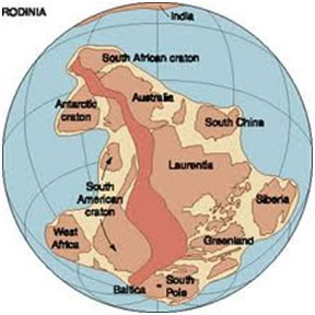
This belt of volcanic rocks and sediments was deposited 650-520 million years ago in a continental rift zone that formed as the supercontinent Rodinia, a predecessor to the better-known Pangaea and Gondwanaland, began to break apart (Fig. 2)
Figure 2. Rodinia (left) and an artist's conception of what Rodinia looked like as it began to break apart 750 million years ago (right).
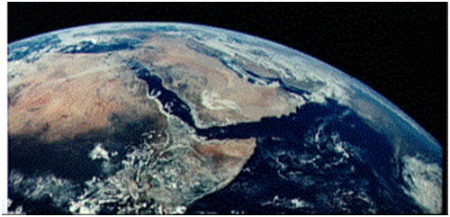
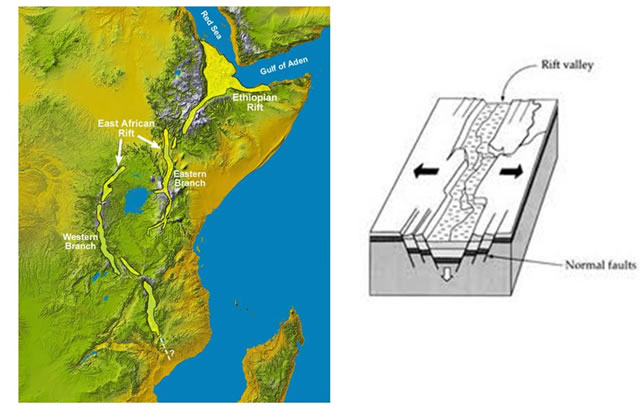
Our best modern analogy is the East African Rift Valleys, a great rift zone forming in the continent of Africa south of where the African continent and the Arabian Peninsula are splitting to form the Red Sea (Fig. 3).
Figure 3. The East African Rift Valleys (arrow).
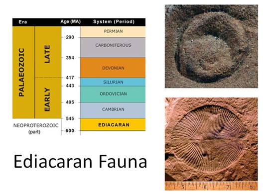
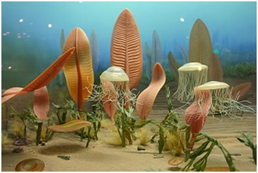
Some of the oldest fossils of complex organisms were discovered in the 1970's in the Carolina Volcanic Slate Belt near Asheboro, North Carolina. These fossils are part of the Ediacaran fauna, named after the hills in Australia where this fauna was originally found (Fig. 4). The Ediacaran fauna is dominated by soft-bodied forms like algae, jellyfish and sponges, but forms with shells are also found (Fig. 5).
Figure 4. Ediacaran fossils. The fossil on the top right was found in the Carolina Volcanic Slate Belt near Asheboro, North Carolina. The jellyfish-like form (bottom left) is from the Ediacaran Hills in Australia.
Figure 5. Artist's conception of what the Ediacaran fauna looked like. Note the jellyfish, sea pens, and trilobites.
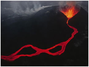
As Rodinia rifted apart, the ground cracked and large segments of the continental crust sank, forming large basins. Volcanoes like today's Mount Kilimanjaro formed along the faults on the boundaries of the rifts and erupted lavas, plumes of volcanic ash, and pyroclastic flows. These volcanic rocks and sediments filled the rift valleys (Fig. 6 and 7).
Figure 6. Formation of the rift valleys in East Africa.
Figure 7. Volcanoes in the East African Rift Zone. Kenya's Mt. Kilimanjaro (left) and lava erupting from the Virunga chain along the border of Rwanda, Uganda, and the Democratic Republic of the Congo (right).
The Carolina Volcanic Slate Belt rift valleys were located in the tropics while they were forming and have been moved northward to their present location by seafloor spreading. There is evidence, however, that volcanoes of a similar age near Mount Rogers, Virginia, were covered with glaciers despite being located in the tropics. This is the oldest Ice Age known.
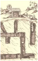
Where you find volcanoes, there are hot springs and fumaroles where hot water and gases escape. The volcanic plumbing deep inside these volcanoes includes veins of quartz, especially in volcanoes that erupt silica-rich lavas known as rhyolites. Rhyolites, along with basalts, make up the majority of the volcanic rocks in the Carolina Volcanic Slate Belt. If the temperature, pressure, gas content, and composition of the liquids and gases are just right, valuable minerals such as gold can concentrate in the quartz veins.
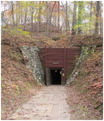
Gold was discovered in the Carolina Volcanic Slate Belt in 1799 at the Reed Gold Mine in North Carolina, the oldest gold mine in the United States (Figure 8). The first discovery was a gold nugget which a jeweler bought from a farmer for $3.50. It was actually worth $3500 in the currency of the time.
Figure 8. The Reed Gold Mine, site of the first gold discovered in the United States. it is now a state park.
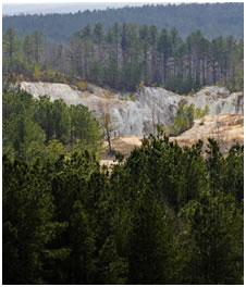
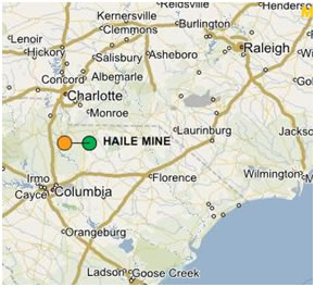
The biggest recent gold strike in the Carolina Volcanic Slate belt is at the Haile Mine site in Kershaw, South Carolina (Fig. 9). Gold was discovered here on a cotton plantation in 1827. From 1827-1939 a total of 369,000 oz of gold, worth $41 million at the time, was produced, making it the second largest mine in the area. In 1985, the Haile Mine was purchased by Piedmont Mining. Piedmont Mining, along with its partner, Amax, sold the mine to Romarco Minerals, a Canadian company in 1992. Romarco drilled the site and found reserves of 3.1 million oz of gold, worth ~$5 billion dollars at present gold prices. Romarco plans to invest $650 million in the mine. Mining is expected to start in 2014 once an environmental impact statement on the impacts of mining on wetlands in the area, which were created by earlier mining efforts, is approved by the U.S. Army Corps of Engineers. The mine will employ 850 people during construction and 300 people during production over approximately 15 years.
Figure 9. The Haile Mine, site of a world-class gold discovery.
As you wander the trails around Kilburnie, you will see large outcrops of rhyolite lava, pieces of volcanic ash that erupted from the volcanoes in the rifts on the edge of the rifting supercontinent of Rodinia long ago. You may also find metamorphosed basalt (greenstone), sandstone, and slate. And, you'll find large pieces of milky white vein quartz. If you look closely at the quartz, perhaps you'll find gold!
|